Russian territories and republics - historical overview
Here is a summary of the russian allied territories, republics and occupation areas;
-
Location
-
government
-
area
-
population
-
capitol
-
summary
Jump list:
[ ARMENIA ][ AZERBAIJAN ][ BATUM ][ FAR
EASTERN REPUBLIC ][ GEORGIA ][ SOUTH
RUSSIA ][TANNU TOUVA ]
[ TRANSCAUCASIAN FEDERATED REPUBLIC ][UKRAINE][ WESTERN UKRAINE ]
ARMENIA
Facts:
| Location: | South of Russia, bounded by Georgia, Azerbaijan, Iran and Turkey. |
| Government: | Republic |
| Area: | 11,306 sq. miles |
| Population: | 3,300,00 in 1989 |
| Capital: | Yerevan |
According to the Russian laws, the post was the monopoly of the State and no other analogous organization was allowed. The Zemstvo Post, on the contrary, was considered as carrying on the work of the State Post in the localities where there was none, but not as competing with it, and thus its organization and its activity was not interfered with. The first Zemstvo-Post has been opened in the Vetluga district of the government of Kostroma; at first, it had no stamps; it was in the Shlisselburg district of the gov. of S.-Petersburg, where a Zemstvo post-office has been opened in Sept. 1865, that they appeared for the first time.
AZERBAIJAN
Facts:
| Location: | Southernmost part of Russia in Eastern Europe, bounded by Georgia, Dagestan, Caspian sea, Persia and Armenia. |
| Government: | A Soviet Socialist Republic |
| Area: | 32,686 sq. miles |
| Population: | 2,096,973 in 1923 |
| Capital: | Baku |
With Azerbaijan and Georgia, Armenia made up the Transcaucasian Federation of Soviet Republics.
Stamps of Armenia were replaced in 1923 by those Transcaucasian Federated Republics.
With the breakup of the Soviet Union on December 26, 1991, Armenia and ten former Soviet republics
established the Commonwealth of independent States.
BATUM
Facts
| Location: | A Seaport on the Black sea |
| Government: | N/A |
| Area: | N/A |
| Population: | N/A |
| Capital: | N/A |
Batum is the capitol of Adzhar, a territory which, in 1921, became an autonomus republic of the Georgian
Soviet Socialist Republic.
Stamps of Batum were issued under the administration of British forces which occupied Batum and environs
between December, 1918, and July, 1920, following the treaty of Versailles.
FAR EASTERN REPUBLIC
Facts:
| Location: | In Siberia east of lake Baikel. |
| Government: | Republic |
| Area: | 900,745 sq. miles |
| Population: | 1,560,00 (in 1920) |
| Capital: | Chita |
A short-lived independent government was established here in 1920.
GEORGIA
Facts:
| Location: | In the southern part of Russia, bordering on the Black sea and occupying the entire western part of Transcaucasia. |
| Government: | A Soviet Socialist Republic |
| Area: | 25,760 sq. miles (in 1920) |
| Population: | 2,372,403 (in 1920) |
| Capital: | Tbilisi (Tiflis) |
Georgia was formerly a province of the Russian Empire and later part of the Transcaucasian Federation of the
Soviet Republics.
Stamps of Georgia were replaced in 1923 by those of Transcaucasian Federated Republics.
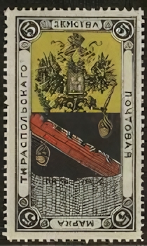
SOUTH RUSSIA
Facts:
| Location: | An area in southern Russia bordering on the Caspian and Black seas. |
| Government: | N/A |
| Area: | N/A |
| Population: | N/A |
| Capital: | N/A |
A provisional government set up and maintained by General Denikin in opposition to the Bolshevik forces in
Russia following the downfall of the Empire.
The stamps were used in the field postal service established for carrying on communication between the
various armies united in the revolt.
These armies included the Don Cossacks, the Kuban Cossacks, and also the neighboring southern Russian people
in favor of the counter-revolution against the Bolsheviks.
TANNU TUVA
Facts:
| Location: | Between the Sayan Mountains and the Tannu-Ola mountains (today it includes all of the Tannu-Ola
mountains, including the southern face and some of the plains to the south). It is basically the basin of the upper reaches of the Yenisei River, which then cuts through the Sayan mountains at the border of Tuva to drain north into the Arctic Ocean. |
| Government: | A former republic closely identified with Soviet Russia in Asia |
| Area: | 64,000 sq. miles |
| Population: | 65,000 in 1927. Today there are something like 300,000 inhabitants |
| Capital: | Kyzyl |
The status of Tuva was settled by treaty between the USSR and the newly independent Mongolia.
Mongolia thought Tuva was part of Mongolia (so did the Tuvans, actually), but Russia wanted it otherwise ---
and the price of Russian support against China for Mongolian independence (without which an independent
Mongolia would never have survived) was that they give up their claim to Tuva.
When Tuva was absorbed by the USSR, it became part of the RSFSR.
Thus later it became part of the Russian Federation, of which it is one of the constituent republics (the
Republic of Tuva, or Tyva RepubliKa).
(with thanks to Alan Leighton)
TRANSCAUCASIAN FEDERATED REPUBLIC
(Armenia, Georgia, Azerbaijan)
| Location: | In southeastern Europe, south of the Caucasus Mountains between the Black and Caspian sea. |
| Government: | A former republic |
| Area: | 71,255 sq. miles |
| Population: | 5,851,00 |
| Capital: | Tiflis |
The Transcaucasian Federation was made up the former autonomies of Armenia, Georgia and Azerbaijan.
Its stamps were replaced by those of Russia.
UKRAINE
| Location: | In southern Europe, bordering the Black sea |
| Government: | Republic |
| Area: | 170,998 sq. miles |
| Population: | 51,940,426 (in 1992) |
| Capital: | Kiev |
Following the collapse of the Russian Empire, a national assembly met at Kiev and formed the Ukrainian
National republic.
On July 6, 1923, the Ukraine joined the Soviet Union and since that time the postage stamps of the Soviet
Union have been in use.
With the breakup of the Soviet Union on December 26, 1991, Ukraine and ten former Soviet Republics
established the Commonwealth of Independent states.
WESTERN UKRAINE
| Location: | In Eastern Central Europe |
| Government: | A former, short-lived independent state |
| Area: | N/A |
| Population: | N/A |
| Capital: | N/A |
A provisional government was established in 1918 in the eastern part of Austria-Hungary but the area later came under Polish administration.